Hike & Travel Accessories
Original price
$16.99
-
Original price
$16.99
Original price
$16.99
$16.99
-
$16.99
Current price
$16.99
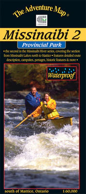
Missinaibi 2 - Missinaibi Lake to Mattice Map
ADVENTURE MAPSALL MAPS FINAL SALE - Most serious paddlers have heard of the Missinaibi River - the longest unbroken stretch of paddling river in Ontario - but th...
View full details
Original price
$16.99
-
Original price
$16.99
Original price
$16.99
$16.99
-
$16.99
Current price
$16.99

Original price
$18.99
-
Original price
$18.99
Original price
$18.99
$18.99
-
$18.99
Current price
$18.99
Killarney Provincial Park Planning Map WATERPROOF
ADVENTURE MAPSALL MAPS FINAL SALE This waterproof, large format, medium-scale (1:55,000) topographic map of the entirety of Killarney Provincial Park, is perfect...
View full details
Original price
$18.99
-
Original price
$18.99
Original price
$18.99
$18.99
-
$18.99
Current price
$18.99
Original price
$6.99
-
Original price
$6.99
Original price
$6.99
$6.99
-
$6.99
Current price
$6.99
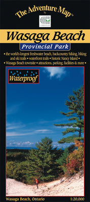
Wasaga Beach Provincial Park & Area Map
ADVENTURE MAPSAll maps are FINAL SALE Scale: 1:20,000. Waterproof. To most people Wasaga Beach means kilometres of white sandy beach on the shore of Georgian Bay...
View full details
Original price
$6.99
-
Original price
$6.99
Original price
$6.99
$6.99
-
$6.99
Current price
$6.99
Original price
$16.99
-
Original price
$16.99
Original price
$16.99
$16.99
-
$16.99
Current price
$16.99
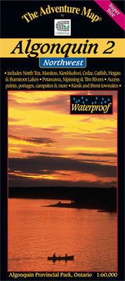
Algonquin 2 - Northwest Map
ADVENTURE MAPSAll maps are FINAL SALE Scale: 1:60,000. Waterproof. Our detailed topographic map & guide to the more remote northwest quadrant of Algonquin Pr...
View full details
Original price
$16.99
-
Original price
$16.99
Original price
$16.99
$16.99
-
$16.99
Current price
$16.99
Original price
$16.95
-
Original price
$16.95
Original price
$16.95
$16.95
-
$16.95
Current price
$16.95
Temagami 1 - Northeast Map
ADVENTURE MAPSAll maps are FINAL SALE Scale: 1:80,000. Waterproof. One of the world's great paddling areas, Temagami provides thousands of lakes and rivers among...
View full details
Original price
$16.95
-
Original price
$16.95
Original price
$16.95
$16.95
-
$16.95
Current price
$16.95
Original price
$15.99
-
Original price
$15.99
Original price
$15.99
$15.99
-
$15.99
Current price
$15.99
Spanish River Provincial Park & Area Map
ADVENTURE MAPSAll Maps are FINAL SALE Scale: 1:60,000. Waterproof. One of southern Canada's great wilderness rivers - the Spanish - is located northwest of Sudbu...
View full details
Original price
$15.99
-
Original price
$15.99
Original price
$15.99
$15.99
-
$15.99
Current price
$15.99
Original price
$16.99
-
Original price
$16.99
Original price
$16.99
$16.99
-
$16.99
Current price
$16.99
Algonquin 1 - Corridor North Map
ADVENTURE MAPSAll Maps are FINAL SALE Scale: 1:60,000. Waterproof. Our detailed topographic map & guide to all paddling routes, hiking & backpacking trai...
View full details
Original price
$16.99
-
Original price
$16.99
Original price
$16.99
$16.99
-
$16.99
Current price
$16.99
Original price
$16.99
-
Original price
$16.99
Original price
$16.99
$16.99
-
$16.99
Current price
$16.99
Sleeping Giant Provincial Park Map
ADVENTURE MAPSA large, medium-scale (1:42,000) waterproof map of the entirety of Sleeping Giant Provincial Park and surroundings that is perfect for planning you...
View full details
Original price
$16.99
-
Original price
$16.99
Original price
$16.99
$16.99
-
$16.99
Current price
$16.99
Original price
$16.99
-
Original price
$16.99
Original price
$16.99
$16.99
-
$16.99
Current price
$16.99
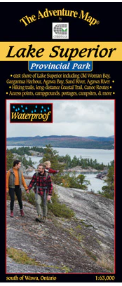
Lake Superior Provincial Park Map
ADVENTURE MAPSALL MAPS FINAL SALE - The eastern Lake Superior coast offers wonderfully rugged wilderness hiking and backpacking as well as coastline and backcoun...
View full details
Original price
$16.99
-
Original price
$16.99
Original price
$16.99
$16.99
-
$16.99
Current price
$16.99
Original price
$12.99
-
Original price
$12.99
Original price
$12.99
$12.99
-
$12.99
Current price
$12.99
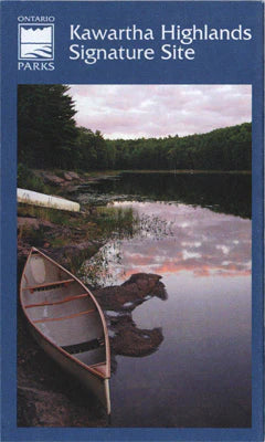
Kawartha Highlands Provincial Park Planning Map
ADVENTURE MAPSALL MAPS FINAL SALE - A medium-scale (1:40,000) paper map of Kawartha Highlands Provincial Park that can be helpful when planning your trip. It sho...
View full details
Original price
$12.99
-
Original price
$12.99
Original price
$12.99
$12.99
-
$12.99
Current price
$12.99
Original price
$9.99
-
Original price
$9.99
Original price
$9.99
$9.99
-
$9.99
Current price
$9.99
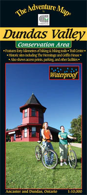
Dundas Valley Conservation Area Map
ADVENTURE MAPSALL MAPS FINAL SALE - A wilderness conservation area between the towns of Ancaster and Dundas, this area is popular with hikers, mountain bikers, a...
View full details
Original price
$9.99
-
Original price
$9.99
Original price
$9.99
$9.99
-
$9.99
Current price
$9.99
Original price
$16.99
-
Original price
$16.99
Original price
$16.99
$16.99
-
$16.99
Current price
$16.99
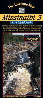
Missinaibi 3 - Mattice to Moosonee Map
ADVENTURE MAPSALL MAPS FINAL SALE - This 3rd guide in our Missinabi series covers the route from the Town of Mattice all the way downstream or northward to Mooso...
View full details
Original price
$16.99
-
Original price
$16.99
Original price
$16.99
$16.99
-
$16.99
Current price
$16.99
Original price
$16.99
-
Original price
$16.99
Original price
$16.99
$16.99
-
$16.99
Current price
$16.99
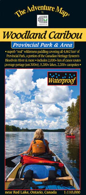
Woodland Caribou Provincial Park & Area Map
ADVENTURE MAPSALL MAPS FINAL SALE - Looking for a huge expanse of world-class wilderness paddling territory? Then Woodland Caribou Provincial Park in northwester...
View full details
Original price
$16.99
-
Original price
$16.99
Original price
$16.99
$16.99
-
$16.99
Current price
$16.99
Original price
$16.99
-
Original price
$16.99
Original price
$16.99
$16.99
-
$16.99
Current price
$16.99
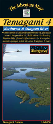
Temagami 4 - Northwest & Sturgeon River Area Map
ADVENTURE MAPSALL MAPS FINAL SALE - This map shows the more remote western side of classic Temagami; the ideal area for a fly-in trip or a lengthy multi-week rou...
View full details
Original price
$16.99
-
Original price
$16.99
Original price
$16.99
$16.99
-
$16.99
Current price
$16.99
Original price
$16.99
-
Original price
$16.99
Original price
$16.99
$16.99
-
$16.99
Current price
$16.99
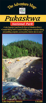
Pukaskwa National Park - Lake Superior Coast Map
ADVENTURE MAPSALL MAPS FINAL SALE - The eastern Lake Superior coast offers a wonderfully rugged wilderness paddling AND backpacking adventure in Pukaskwa Nationa...
View full details
Original price
$16.99
-
Original price
$16.99
Original price
$16.99
$16.99
-
$16.99
Current price
$16.99
Original price
$13.99
-
Original price
$13.99
Original price
$13.99
$13.99
-
$13.99
Current price
$13.99
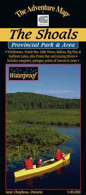
The Shoals Provincial Park & Area Map
ADVENTURE MAPSALL MAPS FINAL SALE - Easy to get to by major highway, this area includes a huge expanse of protected lands and waters within the Provincial Park, ...
View full details
Original price
$13.99
-
Original price
$13.99
Original price
$13.99
$13.99
-
$13.99
Current price
$13.99
Original price
$16.99
-
Original price
$16.99
Original price
$16.99
$16.99
-
$16.99
Current price
$16.99
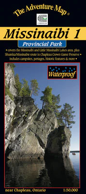
Missinaibi 1 - Lakes Area Map
ADVENTURE MAPSALL MAPS FINAL SALE - Most serious paddlers have heard of the Missinaibi River - the longest unbroken stretch of paddling river in Ontario ...
View full details
Original price
$16.99
-
Original price
$16.99
Original price
$16.99
$16.99
-
$16.99
Current price
$16.99
Original price
$16.99
-
Original price
$16.99
Original price
$16.99
$16.99
-
$16.99
Current price
$16.99
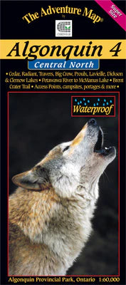
Algonquin 4 - North Central/Petawawa River Map
ADVENTURE MAPSALL MAPS/GUIDES ARE FINAL SALE The fourth in our main Algonquin series, this map covers the area from beyond the park boundary in the north all the...
View full details
Original price
$16.99
-
Original price
$16.99
Original price
$16.99
$16.99
-
$16.99
Current price
$16.99
Original price
$13.99
-
Original price
$13.99
Original price
$13.99
$13.99
-
$13.99
Current price
$13.99
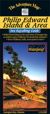
Philip Edward Island & Area - Georgian Bay Map
ADVENTURE MAPSALL MAPS FINAL SALE - The north coast of Georgian Bay is considered to be among the most beautiful of wild kayaking and camping experiences in Nort...
View full details
Original price
$13.99
-
Original price
$13.99
Original price
$13.99
$13.99
-
$13.99
Current price
$13.99
Original price
$13.99
-
Original price
$13.99
Original price
$13.99
$13.99
-
$13.99
Current price
$13.99
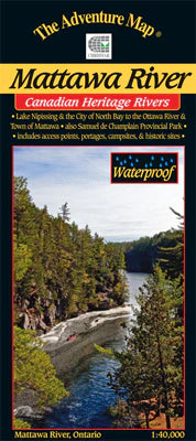
Mattawa River Provincial Park & Area Map
ADVENTURE MAPSALL MAPS FINAL SALE - The Mattawa River is one of Canada's most historic rivers. Stretching between the modern city of North Bay on Lake Nipissing ...
View full details
Original price
$13.99
-
Original price
$13.99
Original price
$13.99
$13.99
-
$13.99
Current price
$13.99
Original price
$13.99
-
Original price
$13.99
Original price
$13.99
$13.99
-
$13.99
Current price
$13.99
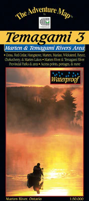
Temagami 3 - Marten River/Temagami River Area Map
ADVENTURE MAPSALL MAPS FINAL SALE - This map shows the less-well-known south-eastern portion of Temagami, which makes it a great paddling location for those hopi...
View full details
Original price
$13.99
-
Original price
$13.99
Original price
$13.99
$13.99
-
$13.99
Current price
$13.99

Original price
$16.99
-
Original price
$16.99
Original price
$16.99
$16.99
-
$16.99
Current price
$16.99
Temagami 2 - Lake Temagami & Area Map
ADVENTURE MAPSALL MAPS FINAL SALE - This map is the heart of Temagami - the octopus-like lake that has become one of Ontario's more popular tourist destinations....
View full details
Original price
$16.99
-
Original price
$16.99
Original price
$16.99
$16.99
-
$16.99
Current price
$16.99

Original price
$16.99
-
Original price
$16.99
Original price
$16.99
$16.99
-
$16.99
Current price
$16.99
Quetico Provincial Park & Area Map
ADVENTURE MAPSQuetico Provincial Park, located in northwestern Ontario on the international border with Boundary Waters Canoe Area Wilderness in Minnesota, is on...
View full details
Original price
$16.99
-
Original price
$16.99
Original price
$16.99
$16.99
-
$16.99
Current price
$16.99

Original price
$13.99
-
Original price
$13.99
Original price
$13.99
$13.99
-
$13.99
Current price
$13.99
Franklin, Mink & McCoy Islands - Georgian Bay Map
ADVENTURE MAPSALL MAPS FINAL SALE - This is one of the most easily accessible, most popular sea kayaking area in all of the Great Lakes. And with thousands of is...
View full details
Original price
$13.99
-
Original price
$13.99
Original price
$13.99
$13.99
-
$13.99
Current price
$13.99